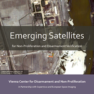
In 2014, the VCDNP won the European Space Imaging (EUSI) and Skybox Imaging High-Res Challenge as part of the 2014 Copernicus Masters Competition, a competition that awards prizes for innovative solutions for business and society based on Earth observation (EO) data.
The goal of the winning project, submitted by Tamara Patton, VCDNP Research Associate and PhD Candidate at Princeton University, was to examine the potential utility of emerging systems of commercial EO satellites to support nuclear non-proliferation, disarmament and treaty verification efforts. The capabilities in focus included emerging constellations of small satellites capturing very high-resolution (VHR) imagery and high definition (HD) video, sub 50 centimeter resolution systems and new regional systems. The project was made possible by the Counter Proliferation Programme of the UK Foreign and Commonwealth Office, and the imagery supplied courtesy of EUSI.
The project's final report is now available for free release. The final report discusses these particular development trends in the commercial EO domain. This is followed by an examination of how such capabilities might apply to observing nuclear fuel cycle or weapon development facilities, using facilities in the Democratic People's Republic of Korea as a case study. Treaty verification requirements are primarily examined in the contexts of the Comprehensive Nuclear-Test-Ban Treaty (CTBT), the Treaty on the Non-Proliferation of Nuclear Weapons (NPT) and the International Atomic Energy Agency (IAEA). New EO capabilities are also examined in the context of the United Nations Security Council nuclear-related sanctions implementation, the Organisation for the Prohibition of Chemical Weapons (OPCW) and nuclear arms control and disarmament efforts.
The report identifies opportunities, obstacles and future considerations for the application of emerging types of commercial EO satellite data in various treaty verification domains. In particular:
- Data provenance: To ensure data provenance and reliability of imagery for verification purposes, extra measures such as digital signatures, as well as the ability to retrace all processing steps that an image undergoes from the satellite to those used by analyst would be useful. Emerging satellite companies could be prepared to share calibration files and documentation on the processing algorithms applied to the data to support international organizations in using their data.
- Treaty verification support: Emerging commercial satellite EO capabilities have the potential to support existing verification mechanisms under nuclear agreements, while also offering new capabilities that might strengthen verification regimes in the future. In the case of the CTBT, small satellites offering agile and more affordable imagery might usefully support existing IMS technologies and on-site inspection mechanisms, including airborne MSIR capabilities. Beyond this, historical archives of global small satellite data could assist in identifying whether or not an explosive event is nuclear in nature by providing high-temporal imagery of a site before the event was detected by the IMS.
- Continued engagement: Small satellite companies, such as Skybox Imaging, Planet Labs, Urthecast, Satellogic and BlackSky Global, are in the early stages of development and may yet be joined by new actors in this expanding sector. This is a critical time for engaging such companies on needs in the field of verification, both in terms of desired capabilities and the restrictions of the operational environment. Many of these companies are actively seeking feedback from current and potential future users of their data to ascertain their needs, and are now in an optimum position to adapt to such needs.

